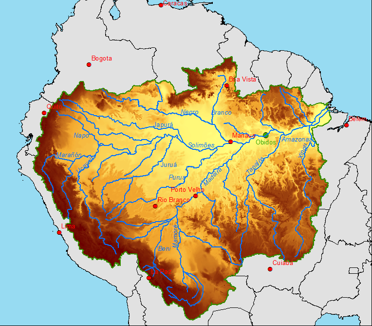
All rivers receive a water supply and the area of land this comes from is known as a drainage basin. The boundaries of the basin are known as the drainage divide or watershed and will usually be marked by areas of higher land. Drainage basins have many different characteristics that influence how quickly or slowly the main river within them responds to a period of intense rainfall, these are outlined in more detail in the section relating to storm hydrographs.
Hydrological cycle

The hydrological cycle is a closed system. Water moves around continuously and no new water is added to or lost from the system.
Drainage basins
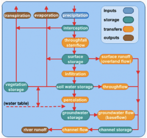
A drainage basin is an open system. The INPUT is precipitation and OUTPUTS occurs through river channels emptying water into the sea or water lost through evapotranspiration. The FLOWS (or transfers) that operate with the system include; surface run-off, infiltration, throughflow, percolation, groundwater flow (also called base flow) & channel flow. STORES of water include vegetation, soil, aquifers, lakes and as ice, including the cryosphere (permanently frozen regions of the Earth’s surface).
On the following blank diagram, add these annotations and a key:
throughflow | groundwater flow into deep rocks | infiltration | precipitation | capillary rise back into soil | evaporation and evapotranspiration | overland flow | percolation | channel flow | throughflow and stemflow | baseflow in bedrock
You need to be familiar with – and be able to explain – these processes: precipitation, evapo-transpiration, interception, infiltration, percolation, channel flow.
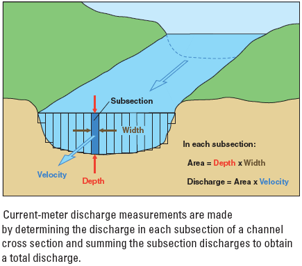
Discharge

The volume of water passing a given point over a given period of time (usually cubic meters per second or Cumecs)
The Bradshaw model, illustrating the changes as a river travels from its source:
River processes
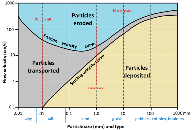
Water can erode, transport & deposit material.
The long course of a river

The Hjulstrom curve

BBC Bitesize – River processes |
|


